For the complete documentation index, see llms.txt.
Ground sensors are required to track spacecraft and collect telemetry data. The Sensors page allows you to create, view, and delete sensor configurations that are used for processing tracking measurements.
A tracking sensor is a fixed ground-based observer that watches spacecraft from the surface — not to be confused with an on-board spacecraft payload, which is a sensor carried by the spacecraft itself (see Payloads on the Spacecraft page).
Route: /orbits/measurements/sensors
Page Layout
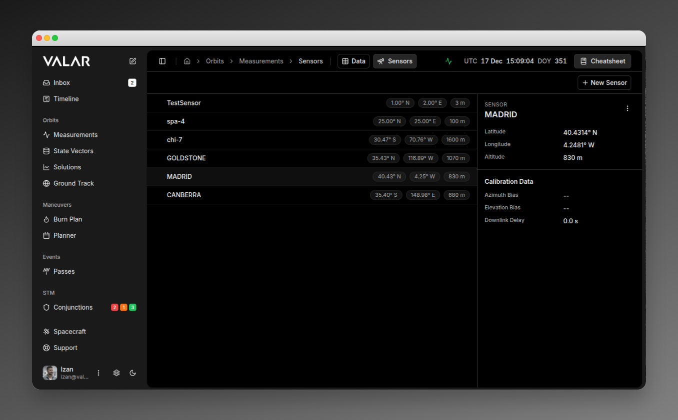
The sensors page has a split-panel design:
 When multiple sensors are selected, a floating action bar appears at the bottom.
Viewing Sensors
The sensor list (left panel) displays all ground sensors in your organization. Each row shows:
- Sensor ID (e.g., “DSN-15”)
- Latitude (e.g., “35.43° N”)
- Longitude (e.g., “116.89° E”)
- Altitude (e.g., “1000 m”)
The first sensor is automatically selected when the page loads.
Viewing Sensor Details
Click any sensor row to view its details in the right panel:
| Section | Field | Format |
|---|
| Identity | Sensor ID | Text (e.g., “DSN-15”) |
| Location | Latitude | XX.XXXX° N/S |
| Longitude | XX.XXXX° E/W |
| Altitude | XXXX m |
| Calibration | Azimuth Bias | Scientific notation (e.g., “1.00e-03°”) or ”—“ |
| Elevation Bias | Scientific notation or ”—“ |
| Downlink Delay | Seconds (e.g., “0.5 s”) or ”—“ |
Creating a Sensor
Click + New Sensor in the top-right corner to open the creation dialog.

Required Fields
| Field | Description | Example |
|---|
| ID | Unique sensor identifier | DSN-15 |
| Latitude (deg) | WGS84 latitude in decimal degrees | 35.4261 |
| Longitude (deg) | WGS84 longitude in decimal degrees | 116.8895 |
| Height (m) | Elevation above WGS84 ellipsoid | 1000 |
Optional Fields (Calibration)
| Field | Description | Default | Example |
|---|
| Azimuth Bias (deg) | Systematic azimuth error | Not set | 0.001 |
| Elevation Bias (deg) | Systematic elevation error | Not set | 0.0005 |
| Downlink Delay (s) | Signal propagation delay | 0 | 0.5 |
Default Configuration
When created, sensors are automatically configured with:
| Setting | Default Value |
|---|
| Type | GROUND_STATION |
| Available | true |
| Elevation Mask | 0° at all azimuths |
| Measurement Types | AZEL and RANGE |
Sensor Types
The platform supports two sensor types:
| Type | Description | UI Support |
|---|
| GROUND_STATION | Ground-based tracking station | Yes (default) |
| TELESCOPE | Optical telescope | API only |
Only GROUND_STATION sensors can be created through the UI. TELESCOPE sensors must be configured via the API.
Outcomes
- Success: Toast notification “Sensor ID created”, sensor list refreshes
- Error: Toast with error message from API
Deleting a Sensor
Single Delete
- Select a sensor by clicking it
- Click the ⋮ (three-dot menu) in the details panel header
- Click Delete Sensor
A confirmation dialog appears:
 Outcomes:
- Success: Toast “Deleted sensor ID”, list updates, next sensor auto-selected
- 404 Error: Toast “Sensor ‘ID’ could not be deleted. It does not exist”
- Other Error: Toast “Something went wrong deleting sensor ID”, list refreshes
Bulk Delete
- Select multiple sensors using checkboxes (checkboxes appear on hover)
- A floating action bar appears at the bottom
- Click Delete
| Button | Action |
|---|
| X selected | Shows selection count |
| Select All | Selects all visible sensors |
| Delete | Opens bulk delete confirmation |
| Clear | Clears all selections |
- Success: Toast “count sensor(s) deleted successfully”, list updates
- Partial Failure: Toast “Failed to delete some sensors”, list refreshes
- Selections are cleared after operation
Important Limitations
No Edit Functionality: Sensors cannot be modified after creation. To change a sensor’s configuration, you must delete and recreate it.
| Limitation | Description |
|---|
| Fixed Measurement Types | All sensors are created with AZEL and RANGE. Cannot be customized in UI. |
| Elevation Mask | Default 0° at all azimuths. Custom masks require API configuration. |
| Organization Scope | Sensors are scoped to your organization. |
| Irreversible Deletion | Both single and bulk delete operations are permanent. |
| Sensor Type | Only GROUND_STATION available in UI. TELESCOPE requires API. |
Doppler Ingestion Configuration
Each sensor may declare a per-sensor twoWayDopplerConvention field that tells the TDM ingestion pipeline how to interpret two-way DOPPLER_INSTANTANEOUS observables produced by that sensor. The two valid CCSDS conventions (MEAN and SUM) differ by a factor of two and are not distinguishable from the keyword alone — declaring the convention explicitly avoids a 100% bias in the observable.
| Setting | Behaviour |
|---|
| MEAN | Observable is the arithmetic mean of uplink and downlink instantaneous rates (DSN convention). |
| SUM | Observable is d/dt of round-trip range; halved at ingest to normalise to MEAN. |
| UNDECLARED | Magnitude-based auto-detection (warning) when within the 10 km/s sanity bound. |
Related Pages