
For the complete documentation index, see llms.txt.The Coverage Map plots every ground station in your organization on a geographic map, each annotated with the coverage shape it can reach at a shared reference altitude. Use it to see ground-segment coverage spatially instead of reconstructing it mentally from a table of elevation and azimuth settings. Route:
/passes/coverage-map
Open the page via the Coverage Map tab in the Passes area’s tab bar, alongside the existing Table, Timeline, and Stations tabs.
What the Map Shows
Every ground station in your organization appears as a marker at its configured latitude and longitude, plotted on the same full-bleed world map used elsewhere in the product. A docked list pane on the right mirrors the map, with one row per station.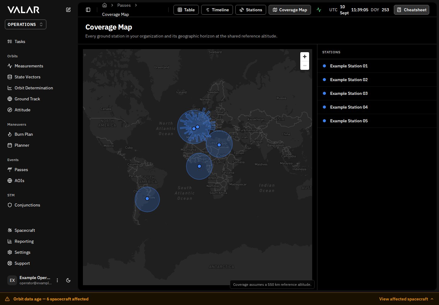
The page is read-only — it visualizes stations, it does not create or edit them. See Relation to the Stations Page below.
Reference Altitude
Every coverage polygon on the map is computed at a single shared reference altitude of 430 km. A caption in the bottom-right corner of the map states this explicitly, readingCoverage assumes a 430 km reference altitude.
One shared altitude is used instead of a different shape per spacecraft because a station’s true reach depends on the altitude of whatever spacecraft is looking down at it — a station can see farther over the horizon for a spacecraft flying higher, and less far for one flying lower. Plotting a single, disclosed reference altitude gives every station a consistent, comparable coverage shape at a glance, rather than an exact-but-mission-specific shape that would need to be redrawn per spacecraft.
Reading the No-Coverage State
A station can end up with no usable coverage at the 430 km reference altitude — for example, when its configured azimuth limits and elevation mask combine to exclude every direction. When this happens, the station’s marker still renders at the same glyph size as every other station, but outline-only, with no filled polygon around it. The marker itself is never hidden.A screenshot of a station in this state will be added here once one is available to capture.
No coverage at the 430 km reference altitude.
Don’t confuse this with the page’s loading state: while station data is still loading, the map and list pane show skeleton placeholders and no station markers render at all. A station rendered outline-only is a real station with a known, computed result of no coverage — not a station that hasn’t loaded yet.